Get seafloor geomorphology data
get_geomorphology.RdGet geomorphological data for a spatial grid or polygon
Arguments
- spatial_grid
sforterra::rast()grid, e.g. created usingget_grid(). Alternatively, if raw data is required, ansfpolygon can be provided, e.g. created usingget_boundary(), and setraw = TRUE.- raw
logicalif TRUE,spatial_gridshould be ansfpolygon, and the raw data in that polygon(s) will be returned- antimeridian
Does
spatial_gridspan the antimeridian? If so, this should be set toTRUE, otherwise set toFALSE. If set toNULL(default) the function will try to check ifspatial_gridspans the antimeridian and set this appropriately.
Value
For gridded data, a multi-layer raster object, or an sf object with
geomorphology class in each column, depending on the spatial_grid format.
If raw = TRUE an sf object with each row as a different
geomorphological feature.
Details
Geomorphological features are from the Harris et al. 2014 dataset, available at
https://www.bluehabitats.org. Data is
included in this package, except depth classification features which can be
created using get_bathymetry() and seamounts which can be retrieved from
a more recent dataset using get_seamounts(). List of features:
Abyssal hills
Abyssal plains
Basins:
large basins of seas and oceans
major ocean basins
perched on the shelf
perched on the slope
small basins of seas and oceans
Bridges
Canyons:
blind
shelf incising
Escarpments
Fans
Glacial troughs
Guyots
Plateaus
Ridges
Rift valleys
Rises
Shelf valleys:
large shelf valleys and glacial troughs
moderate size
small
Sills
Spreading ridges
Terraces
Trenches
Troughs
Examples
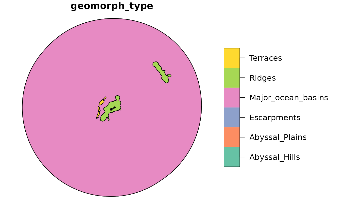
# Grab EEZ data first
bermuda_eez <- get_boundary(name = "Bermuda")
#> Cache is fresh. Reading: /tmp/RtmpHK44st/eez-2205f12f/eez.shp
#> (Last Modified: 2026-07-03 01:41:15.982945)
# Get geomorphology for the EEZ
bermuda_geomorph <- get_geomorphology(spatial_grid = bermuda_eez, raw = TRUE)
plot(bermuda_geomorph)
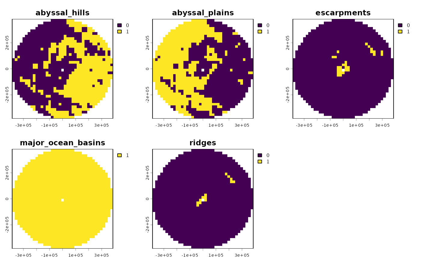
 # Get geomorphological features in spatial_grid
bermuda_grid <- get_grid(boundary = bermuda_eez,
crs = '+proj=laea +lon_0=-64.8108333 +lat_0=32.3571917 +datum=WGS84 +units=m +no_defs',
resolution = 20000)
geomorph_gridded <- get_geomorphology(spatial_grid = bermuda_grid) |>
remove_empty_layers() #helper function to remove data layers that are all zero or NA values
#> although coordinates are longitude/latitude, st_intersection assumes that they
#> are planar
terra::plot(geomorph_gridded)
# Get geomorphological features in spatial_grid
bermuda_grid <- get_grid(boundary = bermuda_eez,
crs = '+proj=laea +lon_0=-64.8108333 +lat_0=32.3571917 +datum=WGS84 +units=m +no_defs',
resolution = 20000)
geomorph_gridded <- get_geomorphology(spatial_grid = bermuda_grid) |>
remove_empty_layers() #helper function to remove data layers that are all zero or NA values
#> although coordinates are longitude/latitude, st_intersection assumes that they
#> are planar
terra::plot(geomorph_gridded)